Settled, cooler conditions over coming days as Storm Darragh clear-up begins
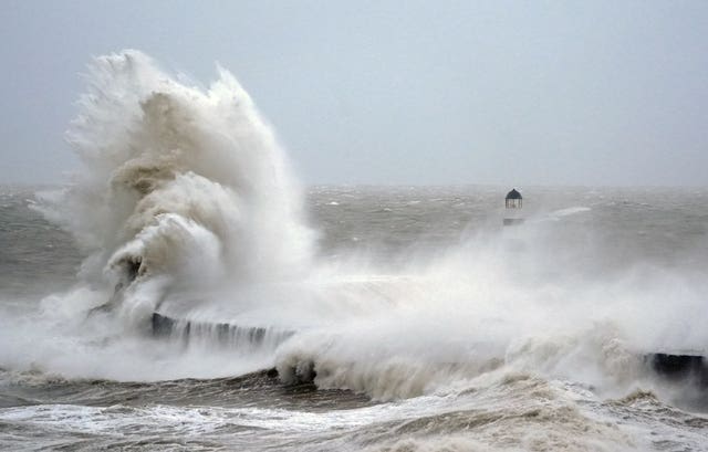
The fourth named storm of the season brought strong gusts to many parts of the country over the weekend, with millions warned to stay indoors.

More settled but cooler conditions will greet much of the UK this week as the clean-up operation from Storm Darragh gets under way.
Winds will gradually ease with noticeably less rainfall by Wednesday but temperatures will stay in the single figures, the Met Office said.
The fourth named storm of the season brought strong gusts to many parts of the country over the weekend, with millions warned to stay indoors.
The highest wind gusts were 96mph, recorded at Berry Head in Devon on Saturday.
Met Office meteorologist Liam Eslick said: “Storm Darragh has now moved its way off towards the south east, so things are going to start to settle down over the next couple of days.
“But it is still going to remain quite blustery, especially for south and south east of England, for the next day at least.”

Much of the rest of the country further north will see calmer winds and plenty of sunshine due to an area of high pressure moving in, but will feel chilly with highs in the mid to low single figures.
Any remaining winds will die down by Tuesday, with the exception of areas around the English Channel and southern coast.
There will again be longer sunny spells developing in northern parts of the country while cloud will settle across Wales and southern England, but temperatures will widely remain low.

More breaks in the persistent cloud cover for southern areas on Wednesday will lead to sunnier spells through the afternoon, and a much drier day nationally, with only East Anglia at risk of some light showers, Mr Eslick said.
The Environment Agency still had 45 flood warnings, meaning flooding is expected, and 145 flood alerts in place across England on Sunday evening.


