
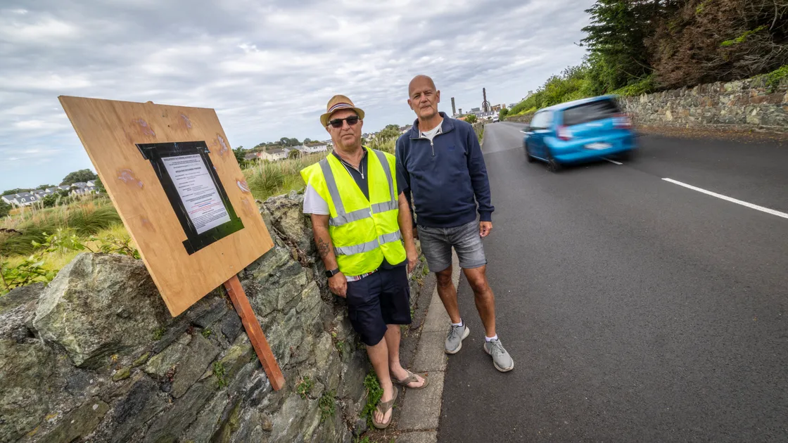
As a former director of Traffic and Highway Services at the States, I am acutely aware of the infrastructure and traffic management challenges facing the States of Guernsey as it seeks to promote accelerated development of the island’s housing stock.
Now serving as a douzenier for the parish of St Sampson’s, I have been heavily involved in the Douzaine’s attempts to limit the extent of exposure of the north of the island to large-scale housing development. This has included drafting various detailed submissions on the proposed amendments to the Island Development Plan, attending the associated planning inquiry sessions and commenting on numerous planning applications.
While acknowledging the need to take its share of housing development in the medium term, St Sampson’s Douzaine has consistently asked that more be done to redistribute the proposed volume of new housing more fairly across the island. It has also highlighted concerns over the ability of existing roads and junctions, utility services infrastructure and surface water drainage facilities to cope with up to 1,500 new houses (equivalent to 75% of proposed new housing in the next seven years) in the north of the island.
It is therefore somewhat ironic that the planning inspector has recently recommended against the creation of a new local centre at Vazon, citing road safety concerns as one of the reasons to oppose a development of just 60 new houses at Whispers Vinery.
The latest proposed amendments to the Island Development Plan further increases the volume of new houses in the north of the island in the next six years. In total the anticipated housing development would increase existing housing stock in the parish by a massive 25%.
The consequences of such levels of development from a traffic management and road safety perspective are considerable, and the efforts of the States of Guernsey to mitigate the impacts, as detailed in an outline planning application for Saltpans Vinery infrastructure, falls short of what would be required.
The application relates to various housing sites, including Parc Le Lacheur, the Saltpans mixed-use development area and Franc Fief, and includes a design and access statement, sustainability statement and traffic impact assessment.
Central to the douzaine’s concerns is the cumulative impact such developments will have on local infrastructure, including:
Local circulation and neighbourhood roads as well as the wider network – leading to junctions operating above capacity with significant queuing and associated road safety concerns.
Surface water flood risk resulting from building large numbers of housing on low lying land such as in the Braye du Valle.
The capabilities of existing public utility infrastructure to meet anticipated demand.
A part of the proposed solution is the provision of a new primary road linking the existing unused traffic signal junction in Route Militaire with Saltpans Road (East), adjacent to Grosse Hougue Quarry. The route traverses the Braye du Valle which, until the early 1800s, was a tidal wetland separating the Vale from St Sampson’s.
The Douzaine acknowledges that a new road in the Braye du Valle, in some form, is necessary if large volumes of housing is going to be built in the area without negatively impacting neighbouring roads and it is acknowledged that wider consideration is currently being given to extending this new road as far as Leale’s Yard. However, it does very little to deal with traffic volumes in the wider area where existing junctions at Crossways and the Halfway are already operating at or over capacity.
A proposed secondary road is intended to provide access to and from Franc Fief Vinery which currently has no safe access for anticipated traffic levels arising from proposed future housing development. This is a particular concern for the Douzaine, as any vehicular access to and from the Saltpans from new development in the Braye du Valle would have dire consequences for traffic management and road safety in this neighbourhood road. The Douzaine is of the opinion that the principal road from the Route Militaire should be linked directly through to Parc Le Lacheur and, if possible, Leale’s Yard, and not join Saltpans Road at all.
In consultations held with parishioners many expressed concern at the high number of proposed developments within the parish and the consequential impacts on parking, traffic management, road safety, property prices and quality of life.
Congestion during the current morning peak in Route Militaire, St Clair Hill and Vale Road was raised, together with road safety concerns at the busy junction of Saltpans, Les Sauvagees and Route Militaire.
There was a groundswell of frustration at the continued prioritisation of such high levels of housing development in the north of the island without apparent concern for the impact on existing residents. Parishioners felt like second-class citizens with preference given to other parishes that objected to change.
The Douzaine strongly believes that a reduction in the proposed level of housing development in the north of the island would help to alleviate some of the concerns that have been raised and save potentially wasted time on applications that cannot hope to satisfy planning policy.
Flood risk is an obvious concern, especially within the Braye du Valle, with surplus rainwater currently absorbed naturally through the land or via the network of douits, many of which led to the Vale Pond. With many new developments set to be built on raised surfaces, and incorporating sustainable drainage systems, there are concerns for existing properties and land given that the water table is generally only between 0.6m and 1.0m below ground level.
Traffic management and road safety were key aspects of my previous working life, and so I have naturally taken a keen interest in this aspect of proposed housing development strategy. The projected significant increases in levels of traffic at peak times resulting from so much housing development remains a major concern for the Douzaine. Unfortunately, the conclusions of the emerging Saltpans masterplan traffic impact assessment report that accompanied the outline planning application for Saltpans infrastructure last year are questionable, and the scale of proposed development is simply incapable of meeting the requirements of Policy IP9 of the Island Development Plan in terms of being able to demonstrate that the existing public road network can cope with the level of development being proposed.
Furthermore, serious concerns have also been raised in respect of the accuracy of some of the data provided in the above traffic impact assessment.
These concerns were highlighted in the Douzaine’s response to the outline planning application last July and relate primarily to the published traffic flow data and predicted trip rates generated from new developments.
In terms of base traffic data, confidence in the published figures is moderate, given the limited survey data provided. However, it is agreed that there has been a significant reduction in commuter journeys post-Covid, perhaps by as much as 20%. Additional surveys should provide more certainty.
Of more concern are the predicted trip rates generated from development of up to 1,488 houses in the north of the island. Confidence here is low, given the significant variance between the latest projections in the traffic impact assessment compared to historical projections which align more closely with data collected by the Douzaine.
In effect, the States projections are only estimating one additional car/light goods vehicle journey in the morning peak rush hour per 3.7 new homes. The surveys undertaken by the Douzaine showed an additional journey per 1.8 new homes. Accordingly, the TIA has significantly underestimated future traffic journeys generated at the morning peak for all proposed development by between 298 and 409 trips.
This is a significant variance and would have a major impact on projected future traffic levels and their impact on existing junctions.
The Douzaine believes that such high levels of development would choke existing road junctions and lead to significant traffic congestion. Accordingly, it considers that any revised traffic impact assessment for the current Saltpans infrastructure planning application or future TIAs accompanying individual housing planning applications need to be based on more robust data to ensure that the true impacts such developments will have on road infrastructure are properly understood.
Concerns have been raised on numerous occasions by the Douzaine; initially to the Development and Planning Authority in response to invitations for comments on the proposed (and revised) amendments to the Island Development Plan, then to the planning inspector as part of the subsequent planning inquiry, and then again in relation to the Saltpans infrastructure outline planning application. The Douzaine will continue to challenge future planning applications for housing developments and any associated traffic impact assessments to ensure that such applications are considered on best and accurate evidence.
Accordingly, the Douzaine remains extremely concerned at the level of proposed additional housing to be concentrated in the north of the island. With roughly 1,500 new homes envisaged in this area in the next six years, including a significant number of additional pipeline and windfall developments, the pressure on existing infrastructure would be significant and more analysis needs to be done to determine what level of development can be safely accommodated.
The Douzaine remains of the opinion that the Development & Planning Authority should reconsider the total number of dwellings proposed to be built across the various housing sites in the north of the island. A more equal and fairer distribution of proposed new housing across the island would lessen the burden on the north of the island and reduce the inevitable impacts that will otherwise be faced by residents of St Sampson’s and especially those living in the vicinity of the Braye du Valle.
It is also suggested that as part of any reconsideration, development of Franc Fief Vinery should be reduced to such an extent that a secondary road is no longer required as part of the application for strategic infrastructure in the Saltpans.
In this way Saltpans Road will retain its integrity and residents will be largely protected from increased traffic flows in the immediate vicinity of their homes. If necessary, slightly higher volumes and density of proposed housing could be considered on sites such as Leale’s Yard.
The Douzaine strongly believes that the Better Transport Plan and other proposed mitigations put forward by the States simply cannot satisfy the requirements of Policy IP9 in terms of the volume of development currently proposed and will continue to argue for a reduction in housing provision in the north of the island on this basis.
In short, the States of Guernsey needs to find a better solution for the distribution of proposed new housing across the island, otherwise much-needed development of new homes will continue to be thwarted at a time of unprecedented demand. The resolve of St Sampson’s Douzaine on this matter is unwavering.
The St Sampson’s Douzaine will be holding its monthly parish surgery on the Bridge by The Mariners’ Inn on Saturday 15 August between 10am and noon. Douzeniers will be available to meet parishioners to discuss any queries they may have regarding issues which affect the parish, a community police officer will also be attending the session and be open to discussing any issues parishioners may have.




You need to be logged in to comment.